Vegetation Management
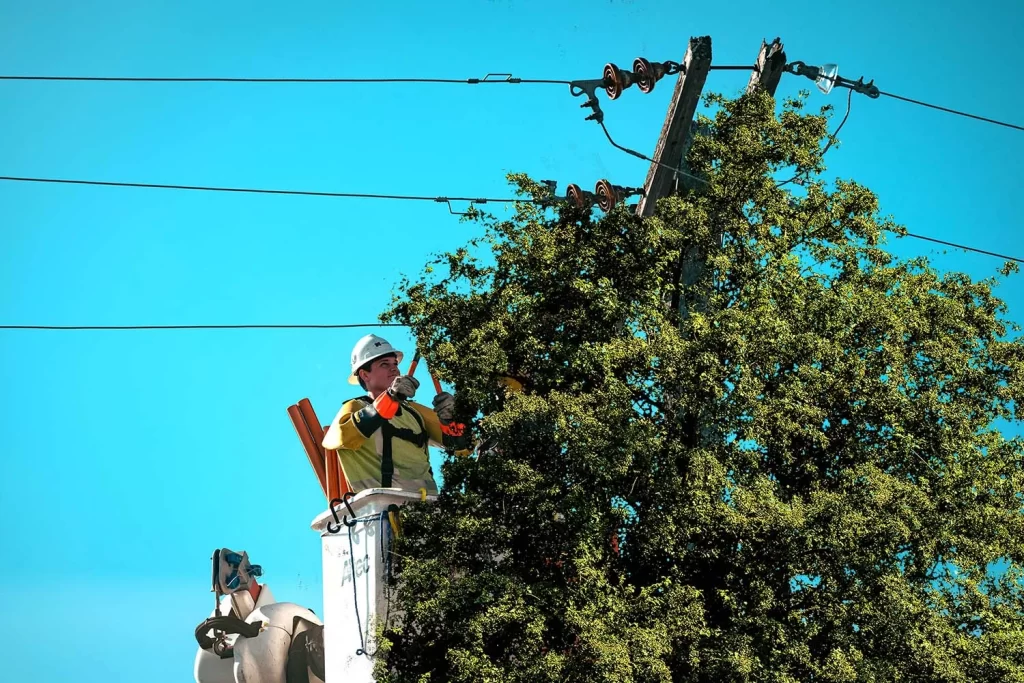
Electricity is a major lifeline of the world, but sometimes, encroachments of vegetation growth, along with other factors, can create difficulties in power supply. Traditional electrical power line inspections have the disadvantages of high labor intensity and low efficiency.
Vegetation management involves removing, controlling, and managing large trees, plants, and other bushes to prevent undergrowth from damaging infrastructure and to reduce the spread of wildfires. This helps reduce flame lengths and the intensity of devastating fires. For the efficient management of utilities and infrastructure development, clearing vegetation obstructions is essential.
Unique Maps provides effective utility vegetation management services. Our solutions help utility companies reduce operational costs and ensure compliance with regulations.
We provide precise geolocation data for hazardous trees, overgrown branches, and shrubs, enabling our vegetation management team to proactively address potential risks. This approach helps minimize unnecessary costs in utility management plans and ensures the implementation of effective, sustainable solutions. By offering tailored, utilitarian strategies, we support enhanced utility management efficiency.
Unique Maps approach the clients with two different solution.
- Lidar and Aerial imagery
- 360° panoramic and satellite imagery
Lidar and Aerial imagery
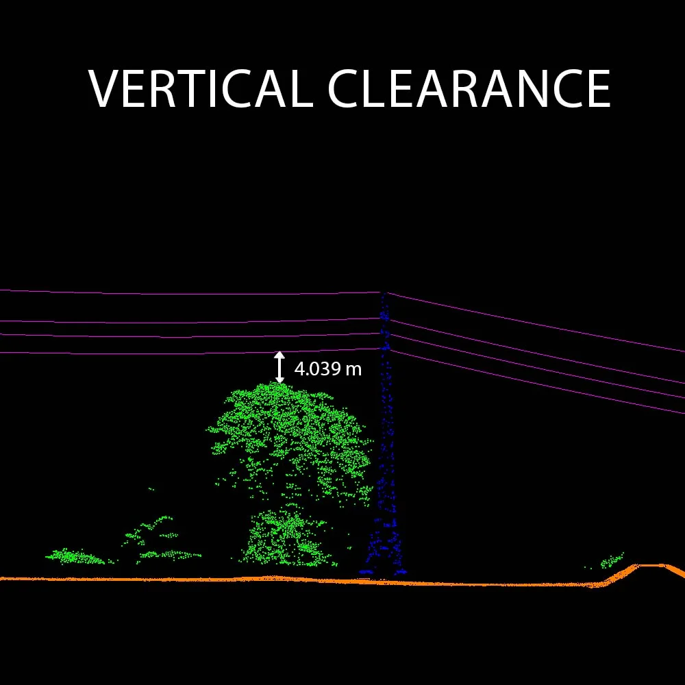
Airborne LiDAR technology enables rapid acquisition of high-precision three-dimensional spatial data of transmission lines. The data collected through this method facilitates the accurate identification of potential hazards. Vegetation point clouds are separated based on elevation and dimensional features from the raw point cloud data, allowing for the extraction of power line and pole points within the transmission line corridor. Subsequently, safety distance analysis is performed on the classified power line and vegetation points. This process effectively mitigates hidden risks to the power supply infrastructure.
Panoramic Image and satellite imagery
Satellite imagery provides valuable insights and enhances offsite monitoring of vegetation encroachment.
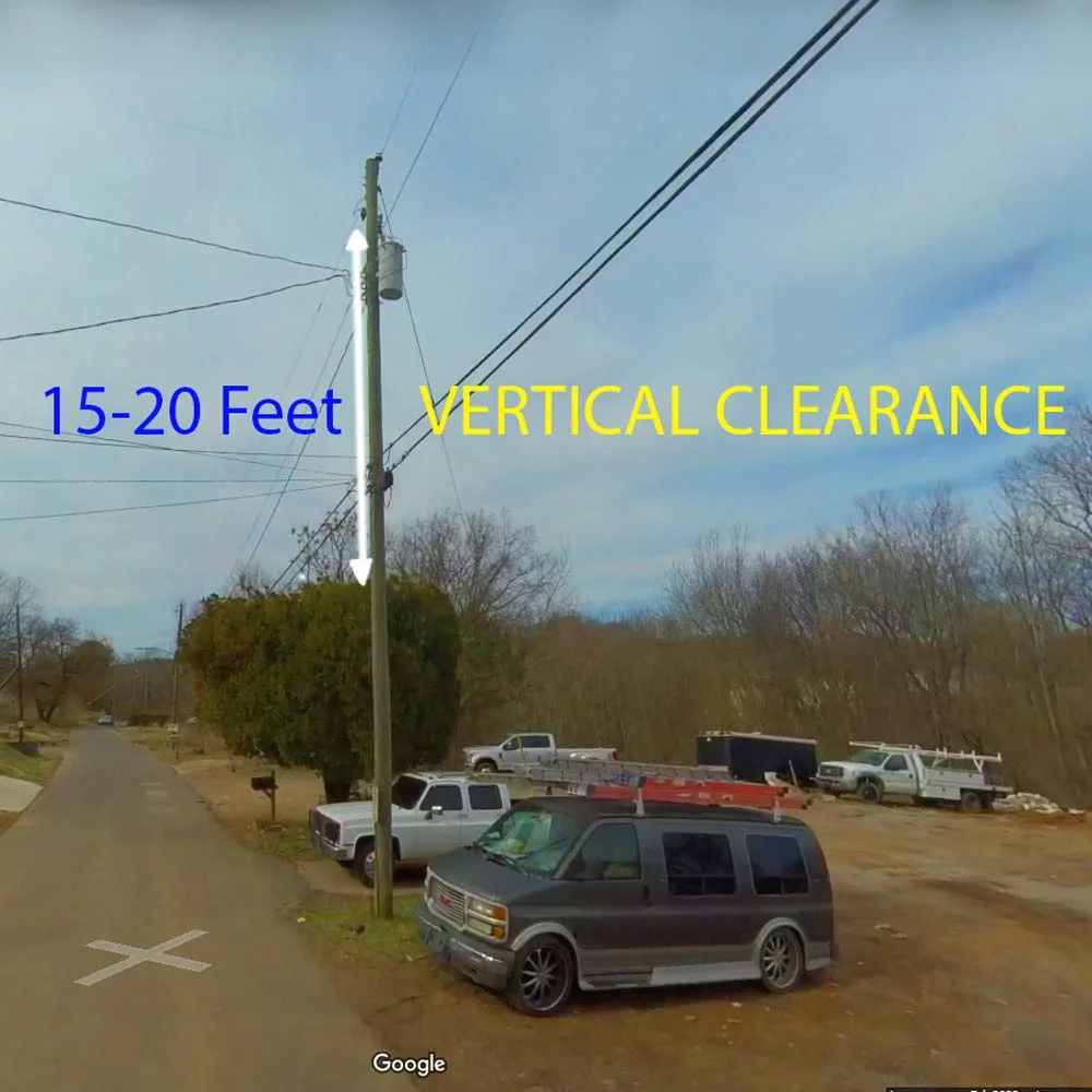
A key aspect of satellite-based vegetation management is accurately identifying electric pole positions in alignment with ground truth data. Safety distance analysis for transmission lines is crucial for power line safety detection, and vegetation management also involves assessing the risks posed by nearby trees. Clearance distances are measured both horizontally and vertically, with 360° panoramic images helping to evaluate vertical clearance.
The entire process can be analyzed by the GIS team and analytics software. Satellite imagery provides a cost-effective option for offsite observing technology of vegetation encroachment.
Benefits of Vegetation Management Services
Reduce Risk and Increase safety
Our simplified vegetation management system detected encroaching vegetation to help you get the risk factors. To solve objectives set in a cost-effective procedure with appropriate consideration for worker safety.
More Accurate
The system organizes plans within your budget and risk-factor classification, planning, and creating work plans and provides the final results are up-to-the-mark solutions.
Increase reliability
Our team provides excellent solutions, enhancing operational efficiency, simplifying all procedures and enabling utilities to provide sustainable, safe, resilient, and reliable strength to the clients.
Cost friendly
The solutions provided by Unique Maps, get the vegetation managers to high productivity and cost-efficient for utility vegetation management.