


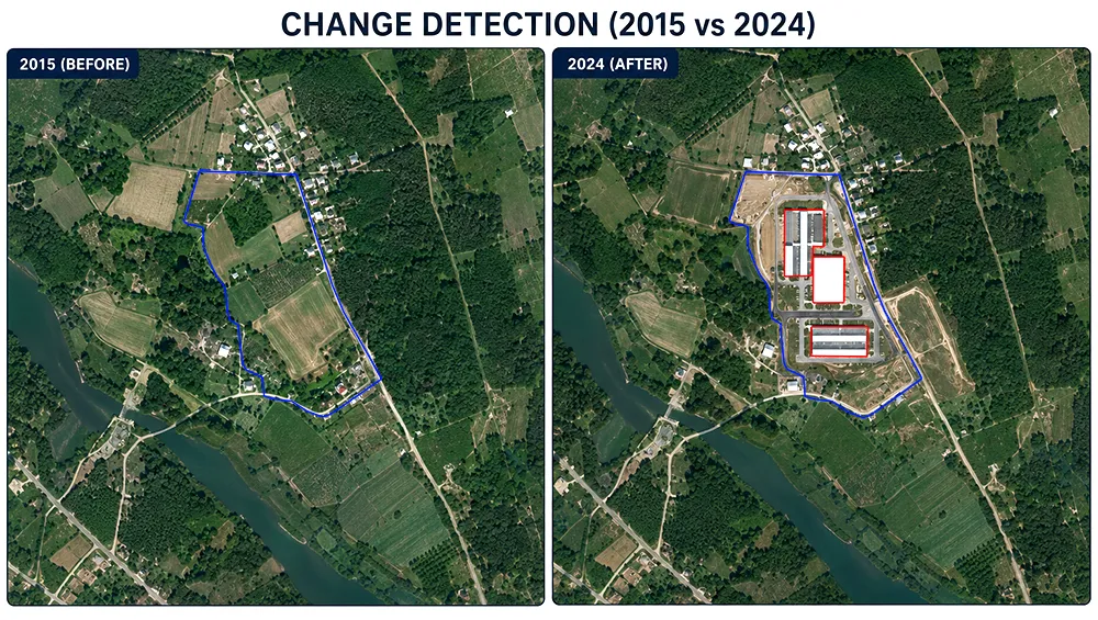
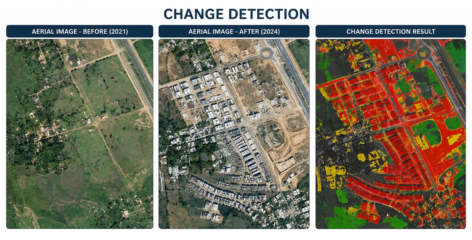
Change detection is the process of identifying and analyzing spatial changes by comparing aerial imagery, satellite imagery, orthophotos, LiDAR data, or geospatial datasets captured at different times. It enables organizations to monitor land development, infrastructure expansion, environmental changes, asset conditions, and evolving landscapes with greater accuracy.
Unique Maps provides advanced change detection services using multi-temporal imagery, GIS analysis, automated feature comparison, and geospatial data processing workflows. Our solutions deliver accurate and actionable change information to support urban planning, infrastructure monitoring, environmental management, utility operations, and informed decision-making.
Historical and current aerial imagery, satellite imagery, orthophotos, LiDAR data, and GIS datasets are reviewed and prepared for accurate comparison.
Datasets are accurately georeferenced, aligned, and standardized to ensure reliable spatial comparison across different time periods.
Spatial changes are detected, classified, and analyzed using image comparison, feature extraction, GIS analysis, and automated change detection techniques.
Comprehensive QA/QC procedures validate detected changes, spatial accuracy, classification consistency, and final geospatial outputs.
Unique Maps uses cookies to enhance your browsing experience, analyze website traffic, and improve our services. By clicking "Accept" or continuing to use our website, you consent to our use of cookies as described in our Cookie Policy.
Manage your cookie preferences below:
Essential cookies enable basic functions and are necessary for the proper function of the website.
These cookies are needed for adding comments on this website.
You can find more information in our Cookie Policy and Privacy Policy.
