-
Aerial Imagery Processing
-
UAV Imagery Processing
-
Satellite Imagery Processing
-
Historical Image Processing
-
Thermal Image Processing
Aerial Imagery
Aerial imagery captures high-resolution images from aircraft or drones for views for precise mapping, analysis, and planning.

-
Aerial LiDAR
-
UAV Aerial LiDAR
-
LiDAR Mobile Mapping
-
Powerline Classification
-
Topographical Mapping
LiDAR
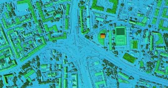
LiDAR technology provides high-precision 3D data for accurate mapping, analysis, and planning.
-
GIS Data Conversion
-
GIS Basemap Creation
-
Cadastral Mapping
-
LULC Map Creation
-
2D Planimetric Mapping
GIS Data Science
GIS Data Science integrates geospatial analysis with data science techniques to extract insights from spatial data.

-
Electric Utility Mapping
-
Water Utility Mapping
-
Gas Utility Mapping
-
Telecom Utility Mapping
-
Road Assets Management
Utility Mapping
Utility mapping identifies and visualizes underground and aboveground utilities for infrastructure planning.

-
Scan to Architectural BIM
-
Scan to Structural BIM
-
Scan to MEP BIM
-
Scan to CAD Drafting
-
Oil and Gas 3D Modeling
-
Scan to Architectural BIM
-
Scan to Structural BIM
-
Scan to MEP BIM
-
Scan to CAD Drafting
-
Oil and Gas 3D Modeling
-
Image Annotation
-
LiDAR Annotation
-
Geospatial Annotation
-
Text Annotation
-
Video Annotation
AI Training Data
Aerial imagery captures high-resolution images from aircraft or drones for views for precise mapping, analysis, and planning.